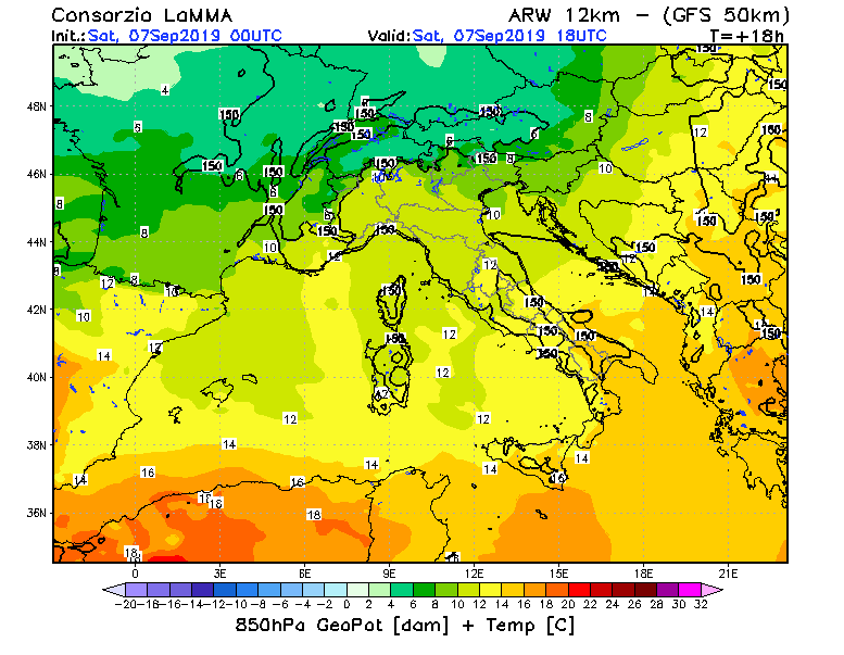
initial time: Sat, 07 september 2019 00UTC
T= +18 h
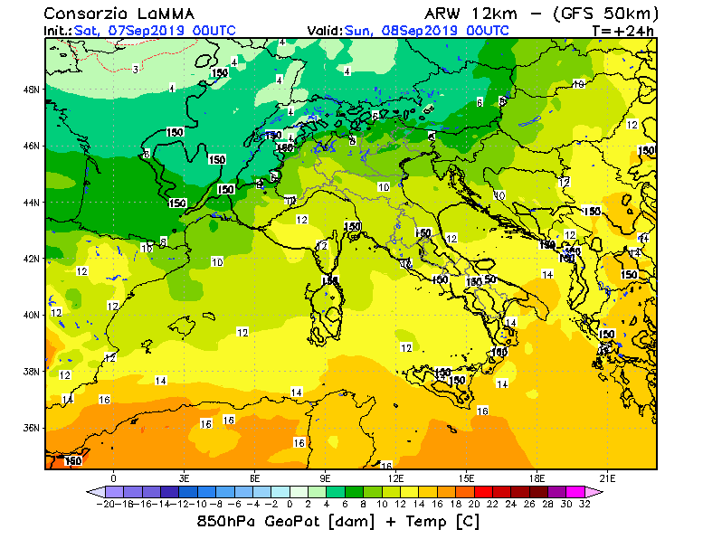
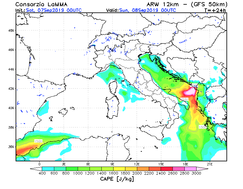
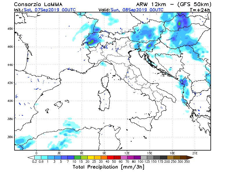
initial time: Sat, 07 september 2019 00UTC
T= +24 h
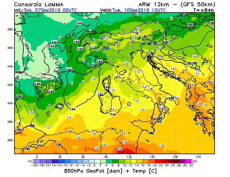
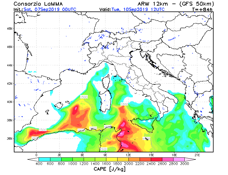
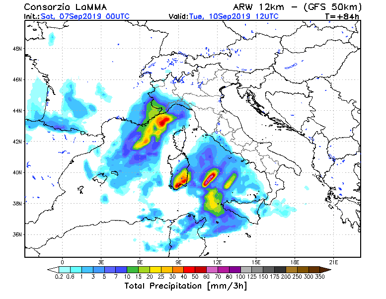
initial time: Sat, 07 september 2019 00UTC
T= +84 h
civil Engineering & land Planning
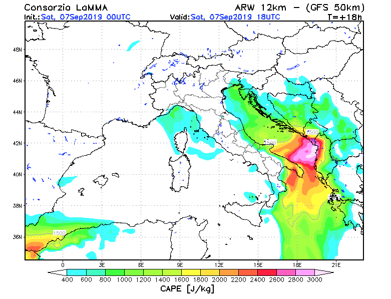
initial time: Sat, 07 september 2019 00UTC
T= +18 h
initial time: Sat, 07 september 2019 00UTC
T= +24 h
initial time: Sat, 07 september 2019 00UTC
T= +84 h
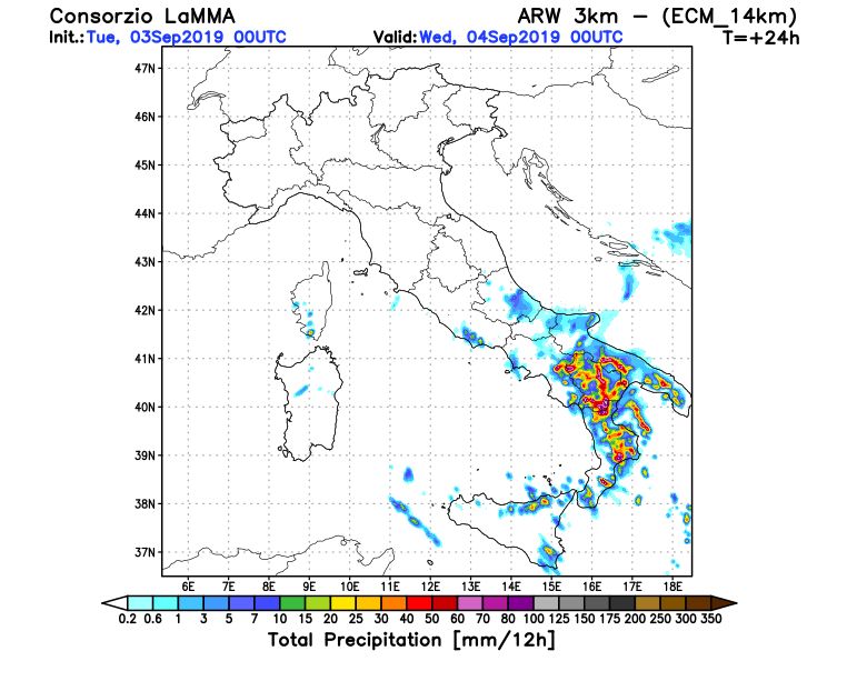
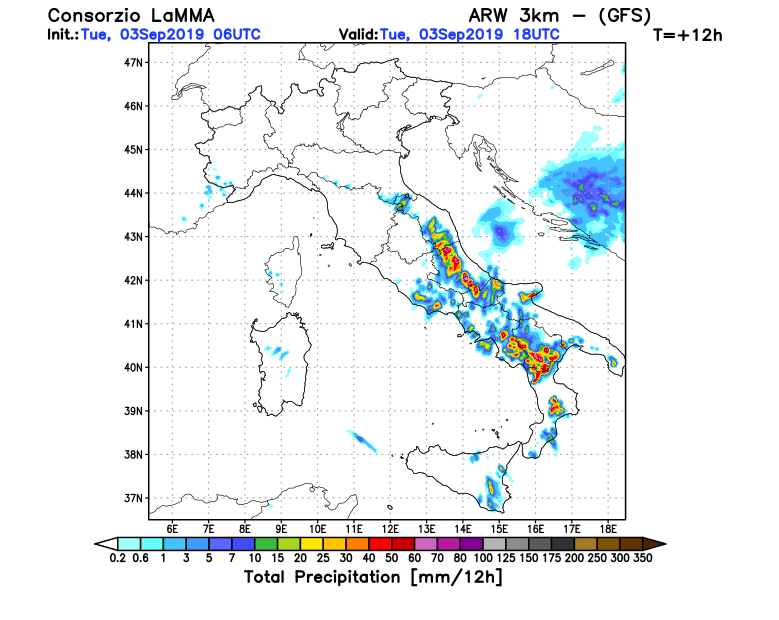
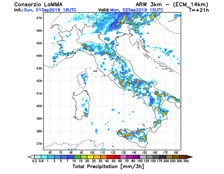
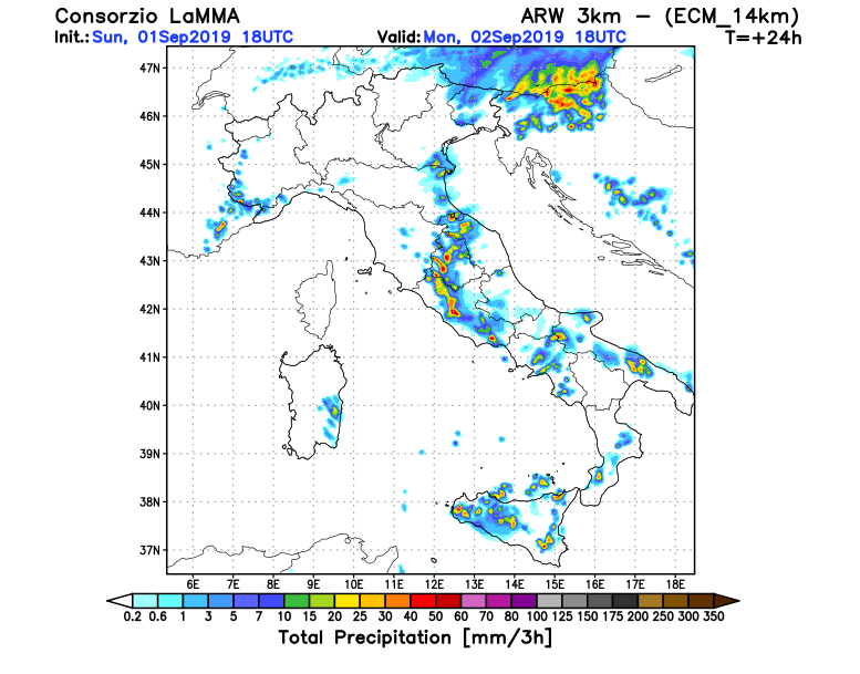
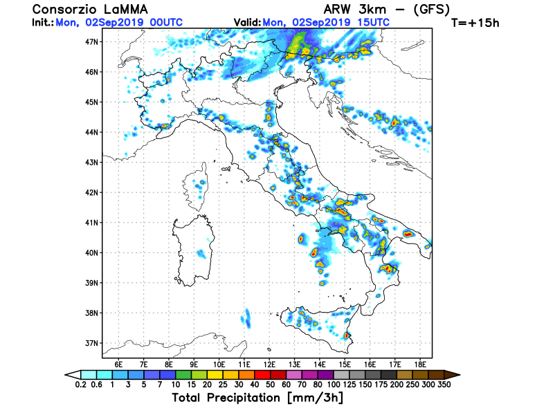
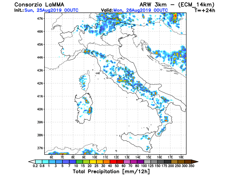
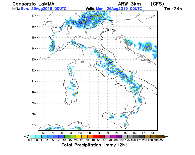
Italy and Malta
Small upper/mid-level disturbances associated with the long-wave trough will provide lift to very unstable air masses. Storms will fire up even before noon and slow storm motions show a high threat for flash floods. Moreover, weak wind field and very unstable air masses over the sea, along with very warm SSTs increase the threat for waterspouts near the coasts of Italy and Malta, as well as in the east coasts of Corsica and the Adriatic Sea later on Wed 04/09.
© ESTOFEX – European Storm Forecast Experiment 2019

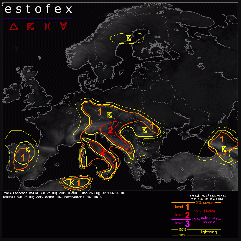
Level 1 and level 2 areas are issued for parts of NE Algeria, NW Tunisia, Corsica, Italy, Austria, Germany, the Czech Republic, Slovakia, Romania, Hungary, Slovenia, Croatia, Bosnia-Herzegovina, Montenegro, Albania, Georgia and SW Russia mainly for excessive convective precipitation and large hail. In addition, non-mesocyclonic tornadoes (waterspouts) are possible in coastal areas.
A level 1 is issued for parts of Portugal and W Spain for large hail, severe convective wind gusts and excessive convective precipitation.
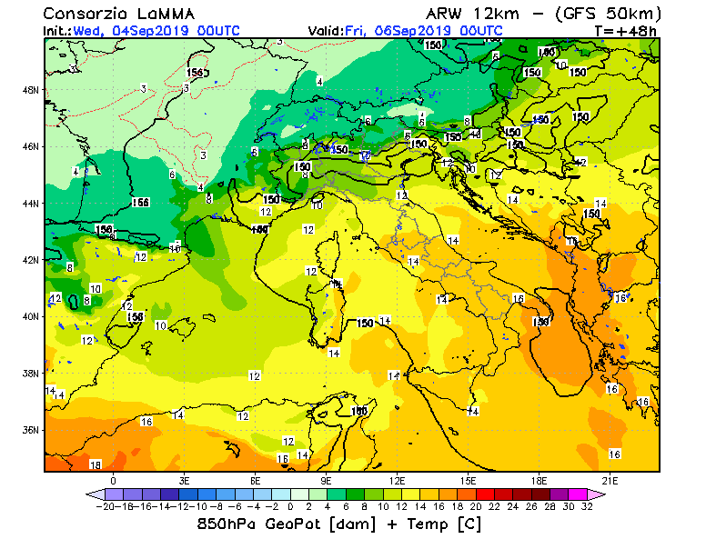
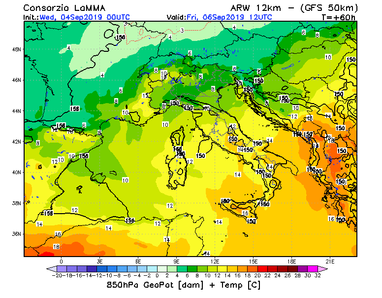
A broad, subtropic ridge filled with very warm to hot air covers most of Europe. It is flanked by small cut-off lows near Ireland and Portugal and by a long-wave trough over Russia. The main frontal zone is deflected to the far north and runs across the Norwegian Sea and Scandinavia.
© ESTOFEX – European Storm Forecast Experiment